The Naletale Monument (or Nharatare “straight-line “or Nhandare “stadium”)
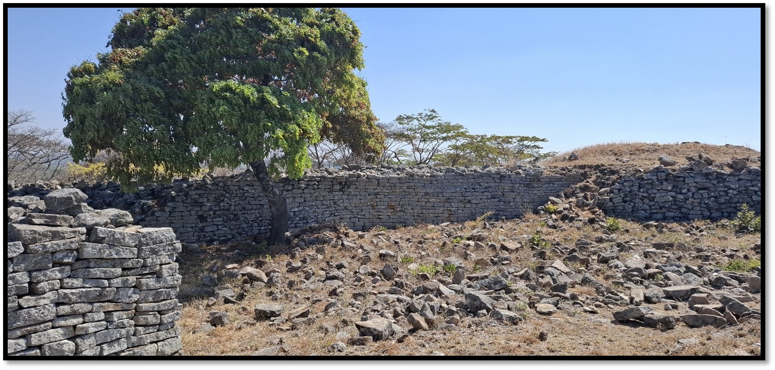
The beautiful little royal ruin of Naletale commands a fine view of the countryside from its elevated position of 1,400 metres and is probably the most architecturally satisfying of all the Zimbabwe dry-stone monuments. The beauty of the site is enhanced by the strange shaped cabbage trees (Cussonia sp) locally named mufenge and the aloes (Aloe chabaudii and Aloe excelsa) which grow out of the walls. The views widen as the visitor ascends the large rounded granite kopje and on a clear day Danan’ombe is visible 22 Kilometres to the southwest.
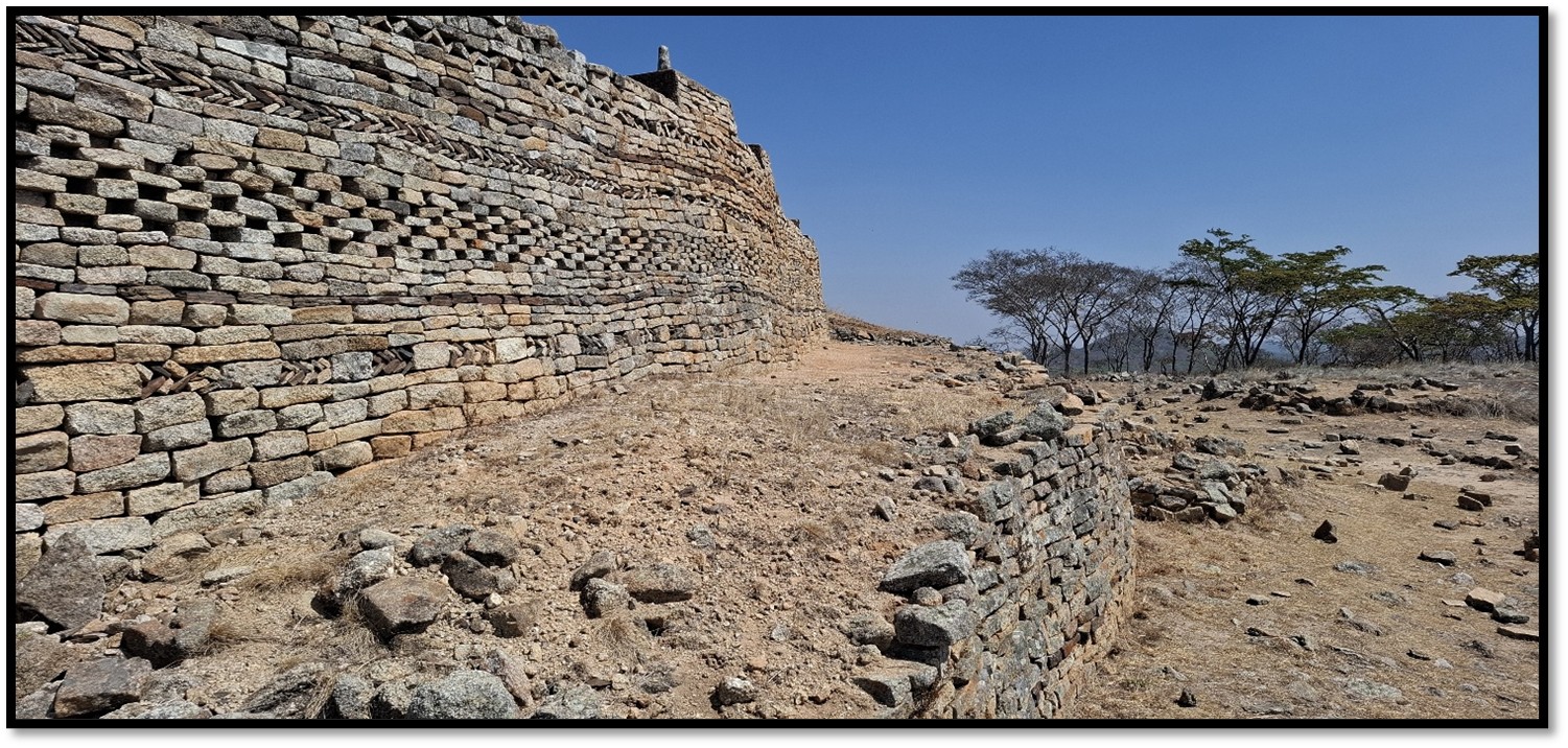
Naletale has undoubtedly the most magnificent decorated walls amongst the 300 dry-stone walled monuments to be found throughout Zimbabwe and the only ruin to have all types of patterning highlighted as banded iron-stone decorations.
Danan’ombe Monument, a few kilometres away, circa 1550 AD was the capital of the Torwa State, often called Butua in early sixteenth Century maps and the central hut at Naletale in the 1550’s may well have been the home of a sub-chief ruled by the King at Danan’ombe before it came to prominence and flourished about 1680 AD.
Both Danan’ombe and Naletale Monuments were initially established by the Torwa before being absorbed by the Rozwi after 1693. The Rozwi, in their turn were defeated by the invading Nguni who moved northwards following the Mfecane upheavals of the 1830’s.
Take the Bulawayo Gweru (A5) as far as Daisyfield which is 16.4 KM from Shangani, or 39.5 KM from the Antelope Park turnoff at Gweru. From Gweru turn left off the national highway onto the gravel road, 0.32 KM turn left and cross the railway track passing a sign in brown which reads Naletale Ruins; 0.7 KM turn left around the school and head south on a good farm track, 7.4 KM enter a lane of giant gum trees, 8.9 KM cross a stream, 10 KM cross another stream, 17.9 KM continue straight on the track, 21.1 KM reach Naletale Site Museum where there is a welcome sign. To return to Shangani via the De Beers Road drive west from the Site Museum, 2.1 KM turn right and drive north for the distances stated below.
An alternative route is from Shangani turn right off the A5 where it is signposted for Naletale / Danan’ombe (formerly Dhlo Dhlo Ruins) O.64 KM turn left for Naletale, 17.7 KM continue straight on ignoring road to the right, 24.1 KM turn left off at signpost for Naletale, 26.16 KM reach Site Museum and park car.
Finally an 800 metres walk up the granite kopje following the seven excellent sign boards with photos and explanations setting out the historical context of Naletale, the architecture, the archaeological excavations that have taken place and finds of local and imported wares, the socio-political background of Naletale and the background to its eventual decline. A final sign board discusses some of the problems of conservation of dry-stone walling and acknowledges the funding through the American Ambassadors Fund for Cultural Preservation (AFCP) The footpath through the mountain acacia takes visitors to the top of the kopje and Naletale Monument at 1,400 metres with marvellous views over the surrounding countryside.
GPS reference for the car park: 19⁰53′18.38″S 29⁰31′55.49″E
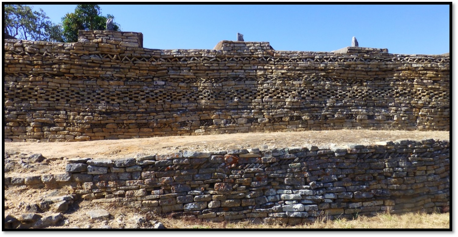
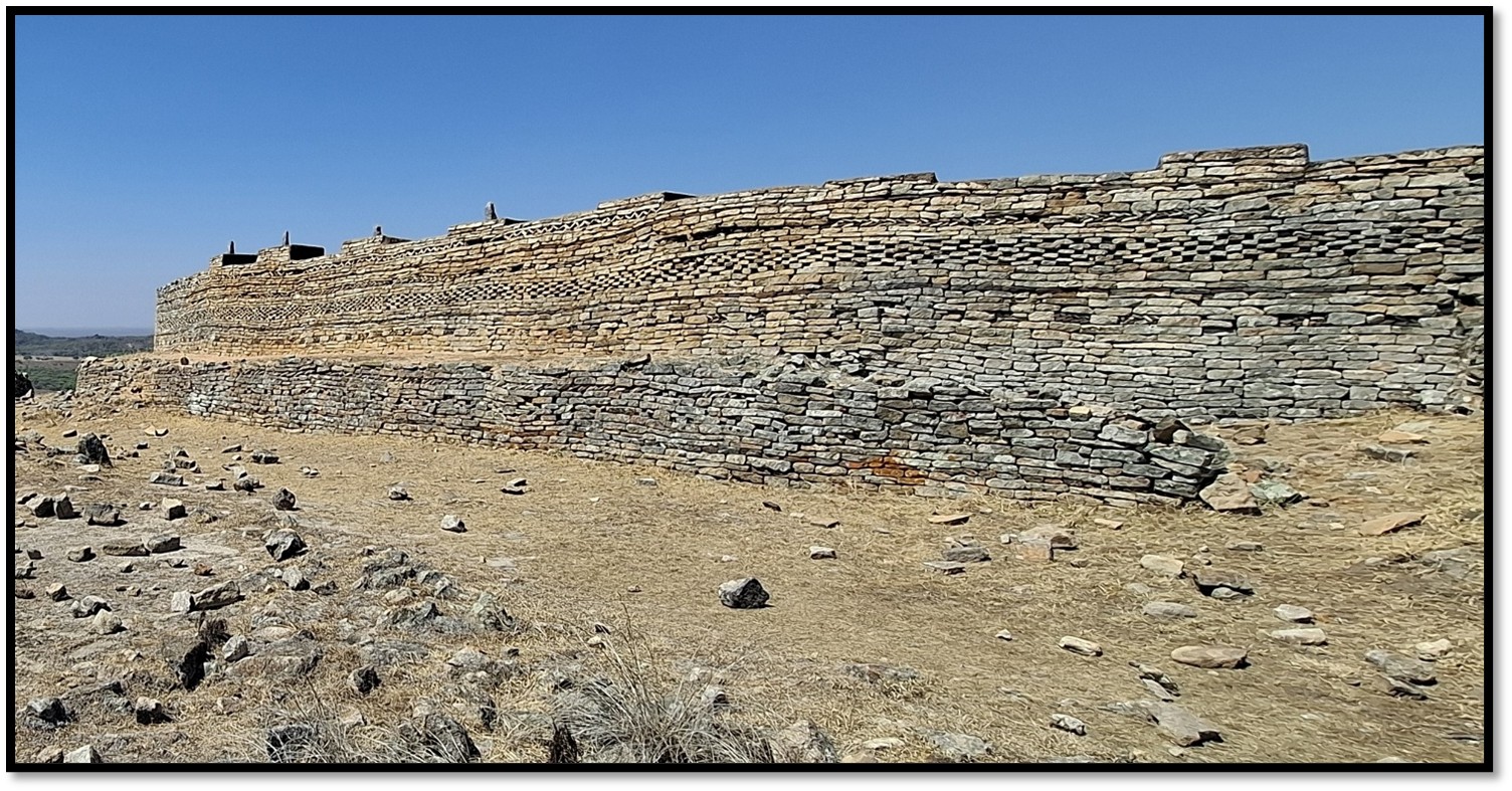 Section of entrance walling at Naletale looking east showing the elaborate wall patterning
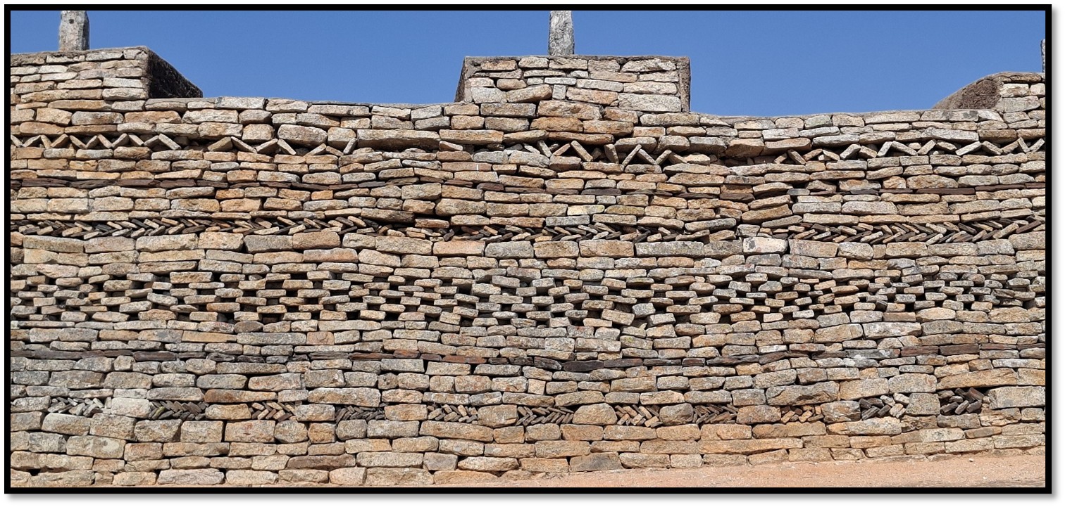
Detailed view of the entrance walling
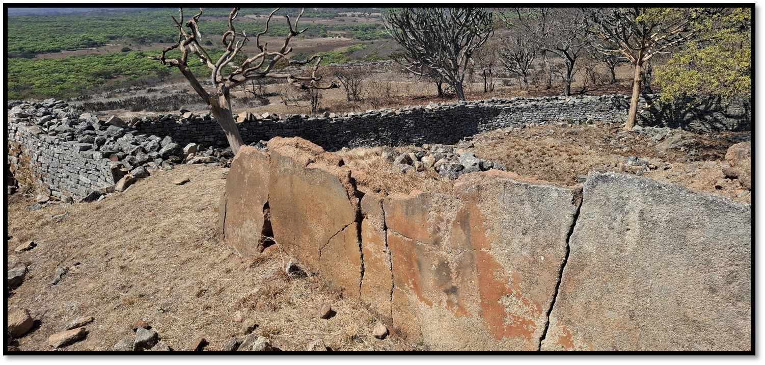
As the visitor approaches the southern side of the building, the elaborate and highly decorated walling becomes evident; chevron, variegated, dentelle, herring-bone, cord and chequer patterns, but in addition, reddish-brown banded ironstone inserts from the gold belt 20 kilometres away highlight the top and bottom sections of the walls which is then topped off with six equally spaced turrets each highlighted with an upright granite piece set in it. These are part of the original building, but because of vandalism, it was essential to cement them in position before they were completely destroyed.
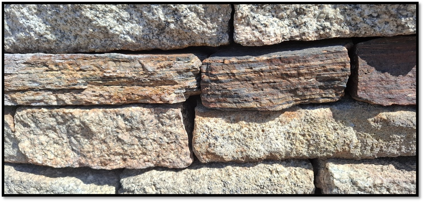
Photo showing a row of banded ironstone rocks to provide a colour contrast in the Naletale walling
Tom Huffman who has done research on the Venda culture suggests the wall patterning is code. For example: check = male crocodile for a man of senior status, herringbone = female crocodile for a woman of senior status, cord = water snake for human fertility, chevron = fertility of the earth.
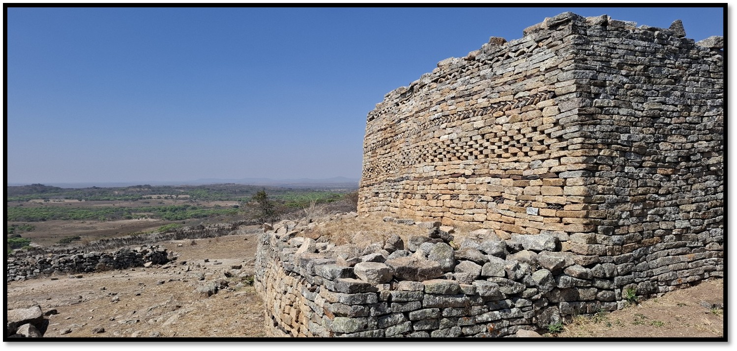
Corner view of Naletale entrance walling looking east
Following the decline of Great Zimbabwe in the 1480’s the Torwa State (Torwa means “strangers” according to Portuguese documents) rose to prominence and the building of Khame commenced in the late fifteenth century and Danan’ombe in the sixteenth century, before the Torwa rulers moved their capital to Naletale in the seventeenth century. Naletale may also have acted as an outlying retreat for the rulers at Danan’ombe and for the purposes of collecting tribute from vassals within the surrounding districts. All these places have the same architectural style of creating terraces within surrounding walls, always built in tiers which needed to be level in order to support the wall decoration (Type 4 platform complexes according to Roger Summers’ classification)
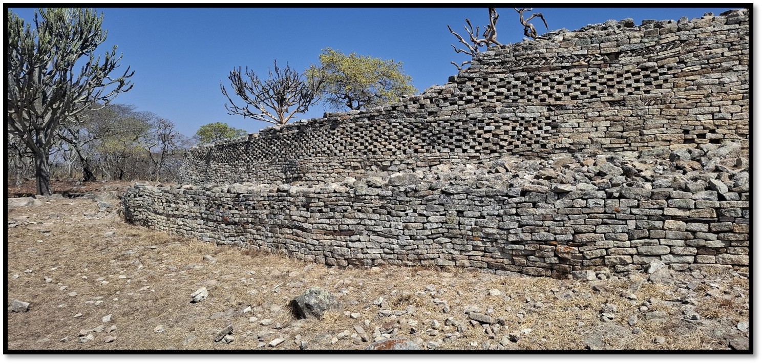
Naletale entrance walling looking west
This Torwa State flourished between 1450 AD and 1693 AD when their wealth in cattle led to envy and they were invaded by the Rozvi, a powerful militaristic grouping that came from north eastern Zimbabwe and conquered and assimilated them. The Rozvi used Naletale as a settlement, but their economy went into a gradual decline in the late eighteenth and nineteenth centuries as their agriculture waned and gold production declined. Additionally civil wars between rivals within the ruling class and between the tributary kingdoms weakened gold production and reduced the once thriving long-distance trade in the decades before 1820. In the 1820’s during the Mfecane at least six Nguni hordes swept through present-day Zimbabwe weakening the Rozwi kingdom even further until the Ndebele moved north came to dominate this part of Zimbabwe.
The walls have been built on substantial platforms
The site had been damaged by treasure seekers, most notably the Ancient Ruins Company and the first archaeological work was carried out in 1905 when Randall-MacIver walked from Shangani siding to do a very short excavation. He found a stone-built underground chamber beneath the central hut and opening to it by a small hole, the chamber was only 1.2 metres deep but widened beneath the dhaka floor of the hut. Randall-MacIver thought it was “a receptacle for valued possessions” but this seems unlikely and similar chambers at Khame and Zinjanja (formerly Regina Ruins) are thought to be grain pits.
Roger Summer’s more comprehensive excavation in 1963 revealed broken local origin pots, similar to that found at Khame and Danan’ombe, which are often brightly coloured with complex patterns forming an elaborate decoration. Foreign imported objects included Chinese blue on white porcelain and wheel-made pottery revealing trade was carried out with the outside world. Numerous local furnace sites within 4 kilometres produced iron nails, twisted copper bangles, spear heads and agricultural hoes and soapstone smoking pipes. They reveal the Torwa were skilled in mining and metal-working.
Eastern end of the Naletale entrance wall showing extensive decoration
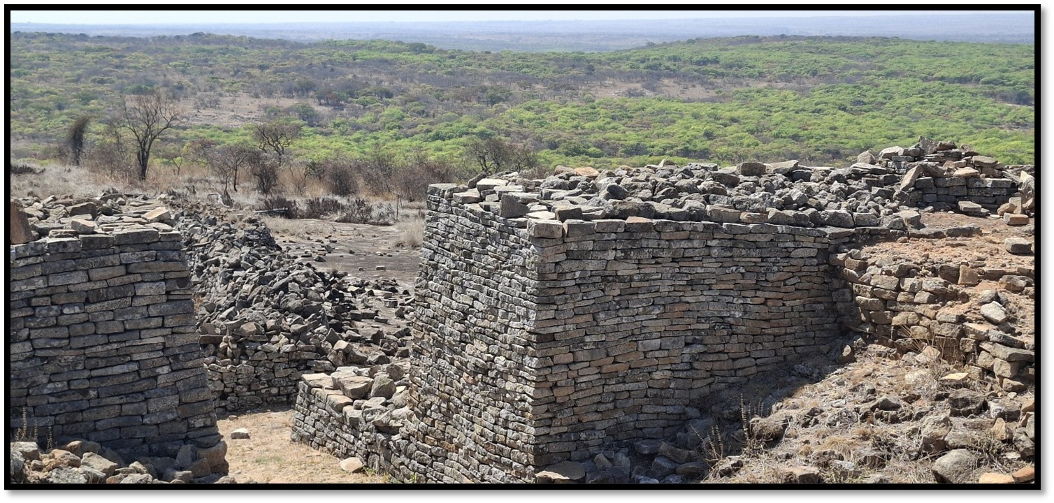
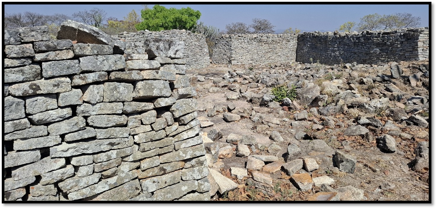
The main structure is an oval-shaped enclosure with a maximum diameter of 53 metres built of dry-stone walling divided into seven internal spaces radiating from the centre which has a central platform 2.5 metres high which was used by the ruler, probably a sub-chief, as his residence. The walls are generally 2 – 2.5 metres high and vary from 1 – 3 metres in width. There are two entrances to the enclosure.
The main entrance into Naletale
The central platform is composed of large stones bound together with several thick horizontal layers of dhaka strengthened with wooden posts inserted at intervals.
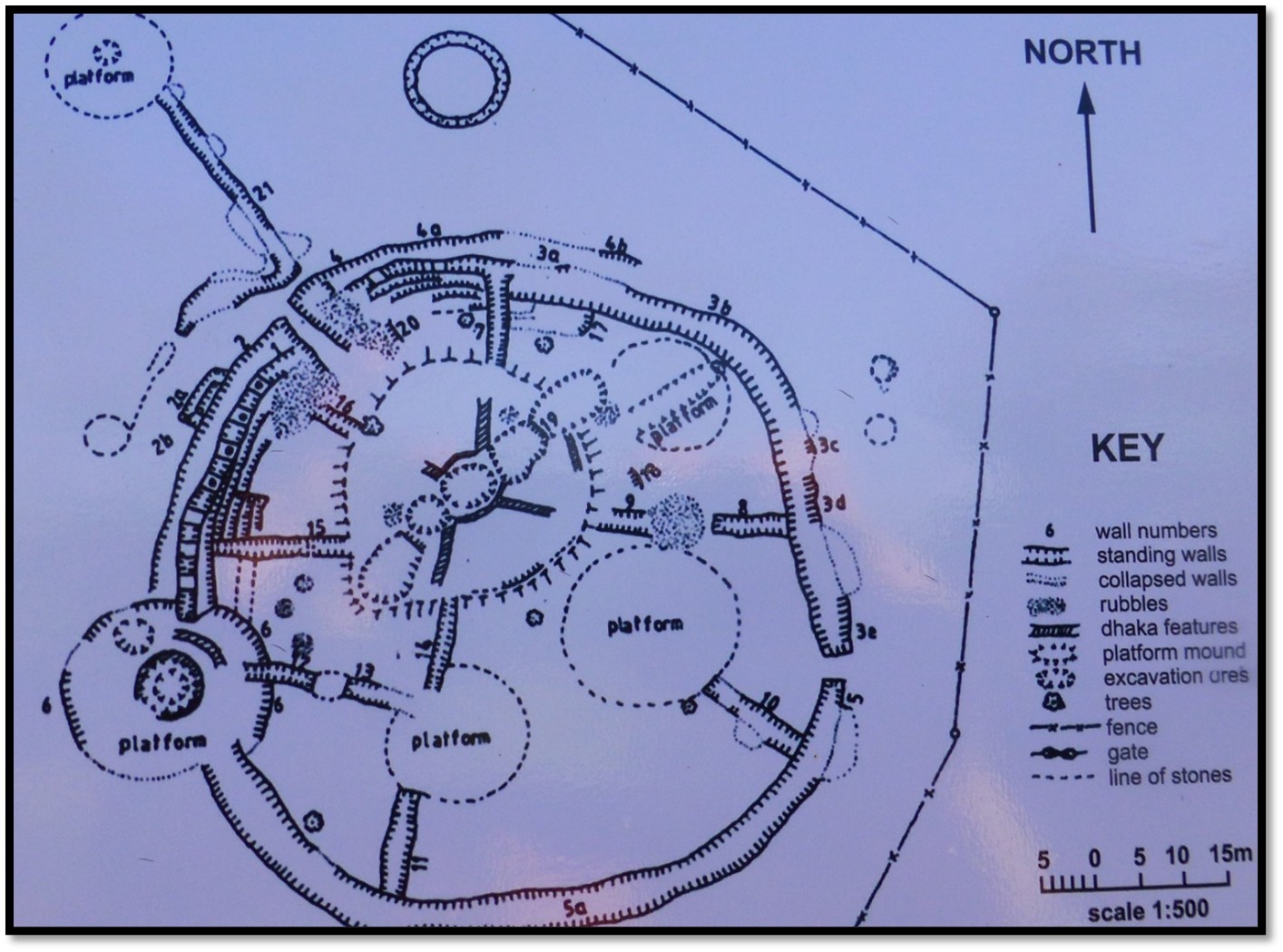
Archaeological Plan of Naletale Monument
The population at Naletale must have been very small as only the traces of four huts were found. Its position is very exposed and windy and all water must be carried a long way from the nearest stream; it was suited for occasional residence or as a retreat only. From the archaeological evidence it appears that the Monument were never totally completed and was constructed relatively late in the wall building period. The stone walls are just the remaining part of the original structure as the huts with their thick compacted dhaka floors have vanished. The stone walls are not defensive; they were designed to flaunt their owner’s wealth over the general population. Naletale may have been a royal retreat where the King would come to relax with his wives and an administrative centre where he could confer with his sub-chiefs.
Interior view of Naletale with dhaka walls
The occupants of Naletale and similar settlements at Danan’ombe and Zinjanja (Regina) probably collected tribute from vassal chiefs under their jurisdiction. Their economy depended on crop cultivation and cattle rearing with a daily diet of cereals and legumes such as millet, sorghum, groundnuts and cowpeas supplemented by meat from their cattle and hunted game. Underlying the economic wealth of the whole community were cattle and farming and gold mining. Gold and ivory was exchanged with Swahili merchants from the east coast of Africa; this trade had been carried on since the days of Mapungubwe and Great Zimbabwe in exchange for glass beads, cloth, and porcelain and glass vessels. The Portuguese took Sofala in 1505 and tried to oust the Swahili merchants, but with limited success.
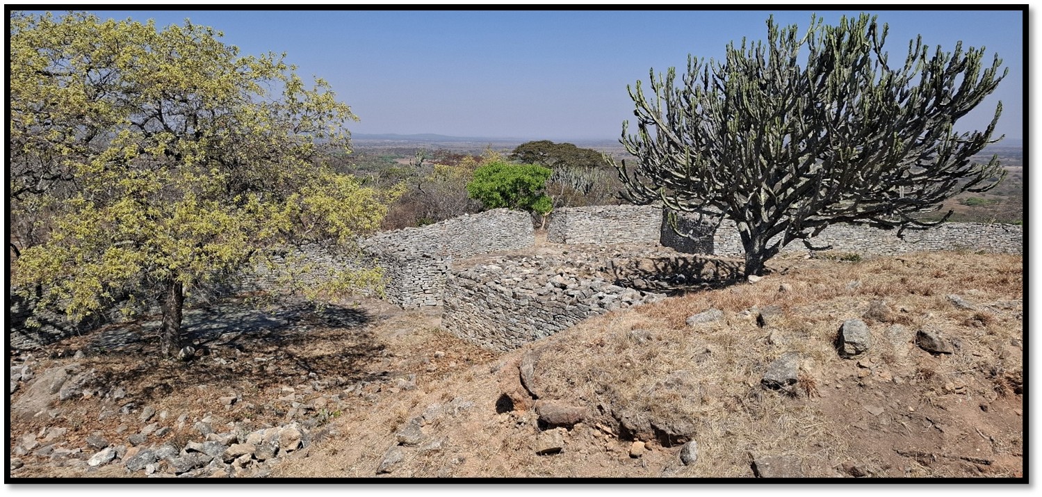
View over the southern interior of Naletale
Dry-stone walls are very prone to structural subsidence and over the years sections of walling had collapsed and were in need of restoration. Chris Dunbar made an application to the World Monuments Fund (www.wmf.org) which resulted in Naletale being nominated to the 2012 Watch; but funding was not awarded until November 2013 when the Ambassadors Fund for Cultural Preservation of the U.S. Department of State awarded the National Museums and Monuments of Zimbabwe (NMMZ) sufficient funds for the restoration of the outer wall and radiating interior walls as well as the main entrance walls. This project was completed between 2012 - 2014 and was carried out by local stone-masons and archaeologists from NMMZ.
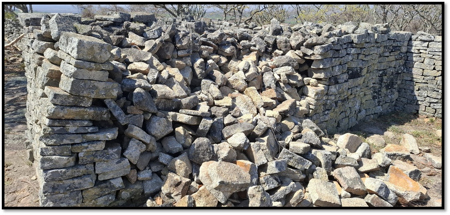
Section of collapsed walling at Naletale
Section of recently restored walling at Naletale Monument
Visitors may find useful supplementary reading in Khami, Capital of the Torwa State by Rob Burrett and Paul Hubbard published by Khami Press in 2013
Eastern walling at Naletale