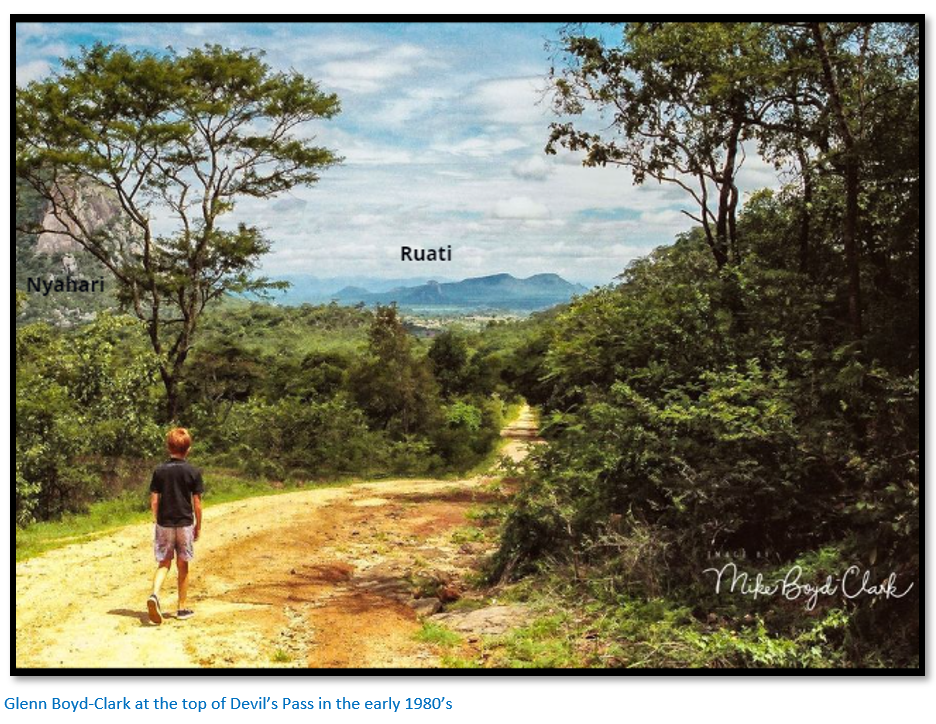
Devil’s Pass and Fort Watts

Why Visit?: 
  • The Devil’s Pass is almost unknown to people living in Zimbabwe nowadays. 
  • The construction on the railway line from Fontesvilla, 56 kilometres from Beira began in September 1892. The 222-mile (355 kilometres) link to Umtali (now Mutare) was built with 2ft 0-inch track gauge using 20lb / yard rail and only completed in February 1898 after immense difficulties had been overcome and many lives lost. On 22nd May 1899, the 3ft 6-inch gauge railway link between Umtali and Salisbury (now Harare) was completed; the Umtali Beira line being converted to the same standard gauge by August 1900.
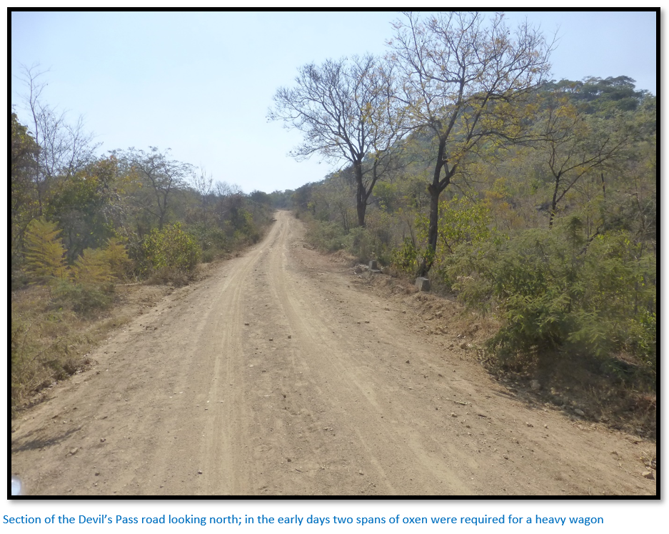
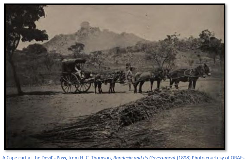
  • For the period 1890 to 1899 all traffic between Umtali and Salisbury was by ox-wagon mostly through the Devil’s Pass. The altitude at the highest point of the Pass is 1,446 metres, at its base it is 1,286 metres; so, the oxen had to haul up their wagons 160 metres over a distance of 2.4 KM. This is a formidable gradient for a span of sixteen oxen harnessed in pairs drawing a wagon load of 4 to 5 tons.
  • A normal day’s travelling might be 20 KM, but this depended on the rivers and steep inclines that were encountered.  At the bottom of the Devil’s Pass one or two teams would be detached from other wagons and each wagon would be double or triple-teamed in order to get to the top of the Pass. This meant that each team of oxen would make two or three trips and needed to be rested when all the wagons were finally up and meant only the 2.4 KM of the Devil’s Pass would be covered in a day. After overnight rain, the trail would be like grease and on these days, there was nothing to do but wait for the road to dry. 
  • Returning to Umtali down the Devil’s Pass was usually with a lightly-loaded wagon. They had large wood blocks on the rear wheels which were the brakes and were operated by a handle attached to a large turn screw. In addition to the driver and voorlooper, someone had to walk behind the wagon ready to apply the brakes at a moment’s notice to prevent the wagon from rolling over the oxen pulling it. Sometimes twelve of the oxen were moved to the back of the wagon, leaving four to steer the wagon while the remaining twelve held it back, helping the brakes and in the event of a runaway, reduced the number of casualties among the precious oxen.
  • The arrival of the railway which followed the watershed to the west was followed by the roads and so the old wagon route through the Devil’s Pass became abandoned and forgotten.
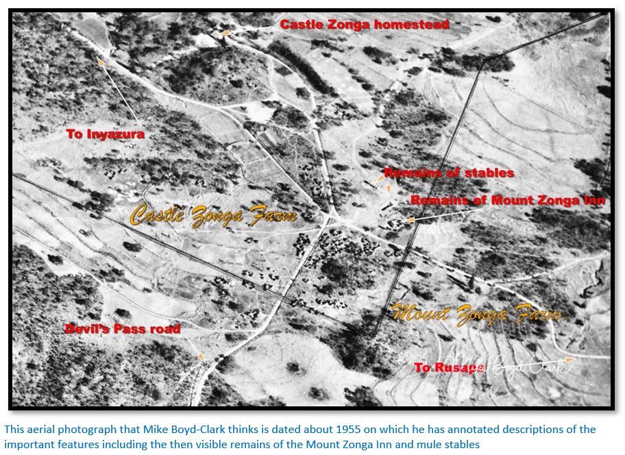
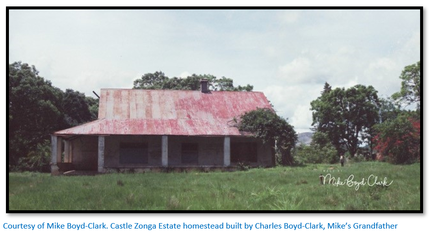
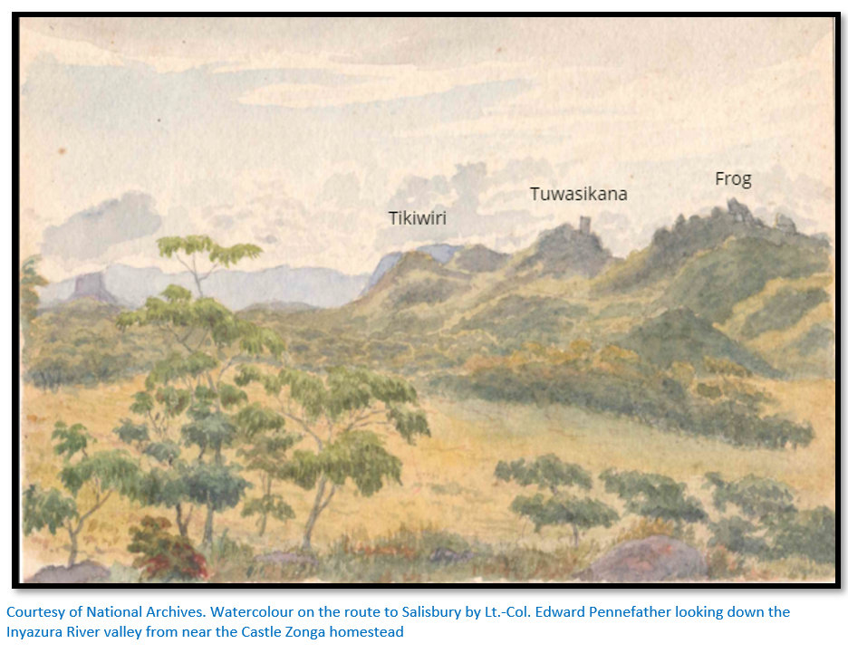
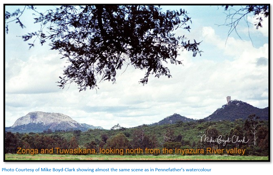
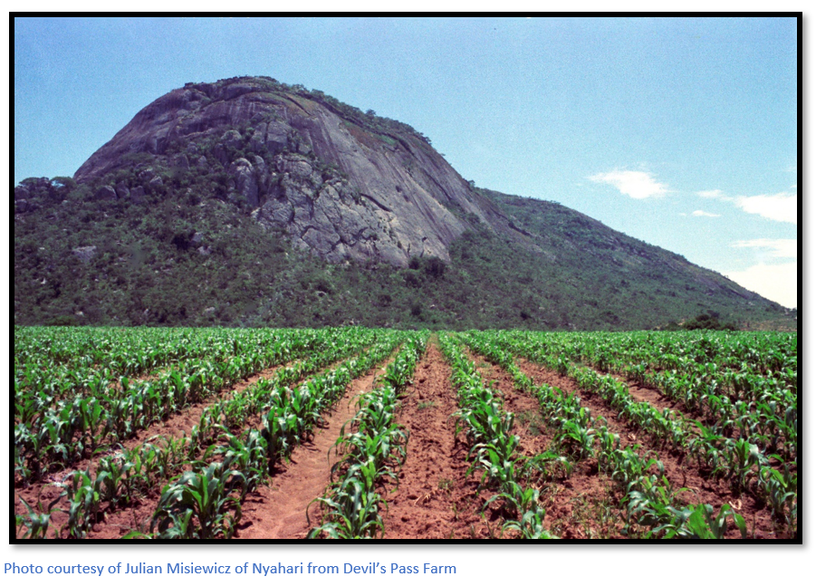
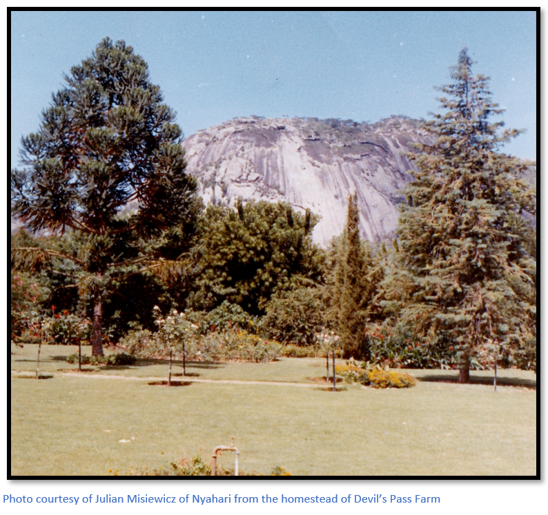
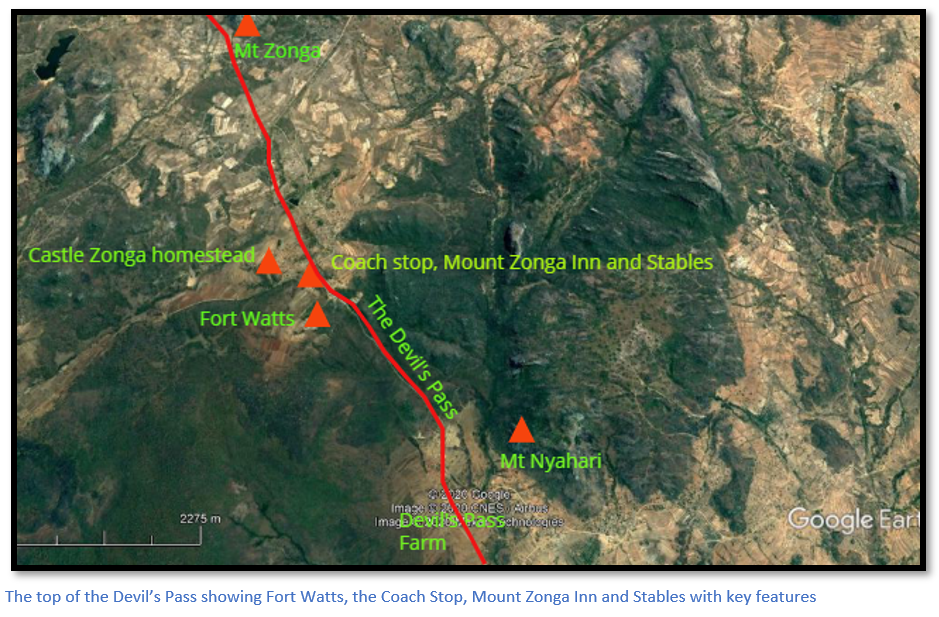
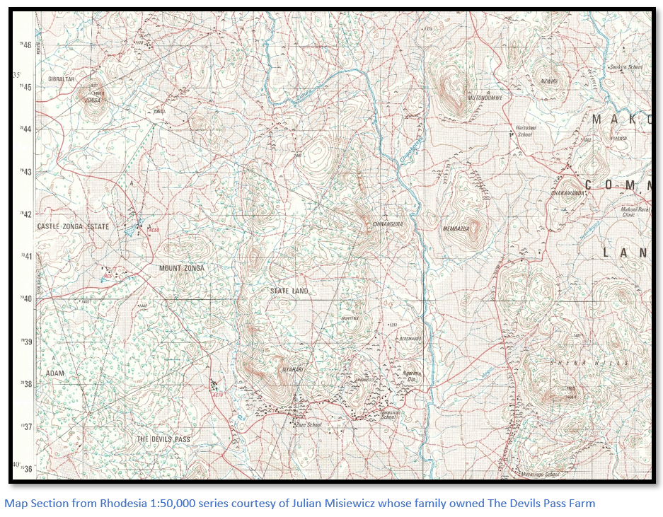
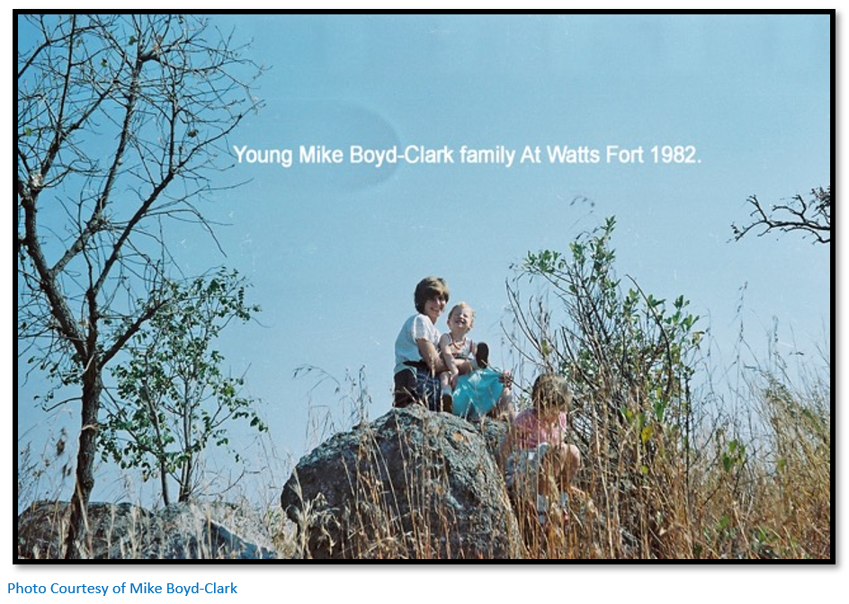
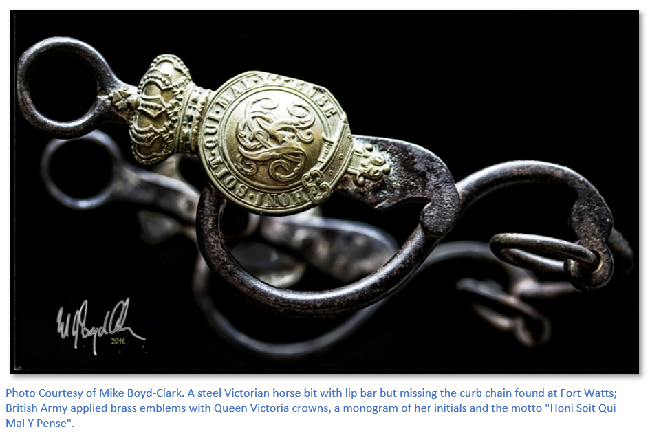
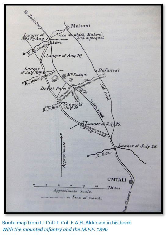
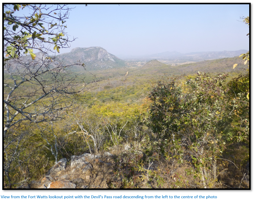
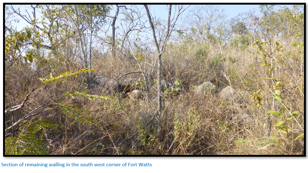
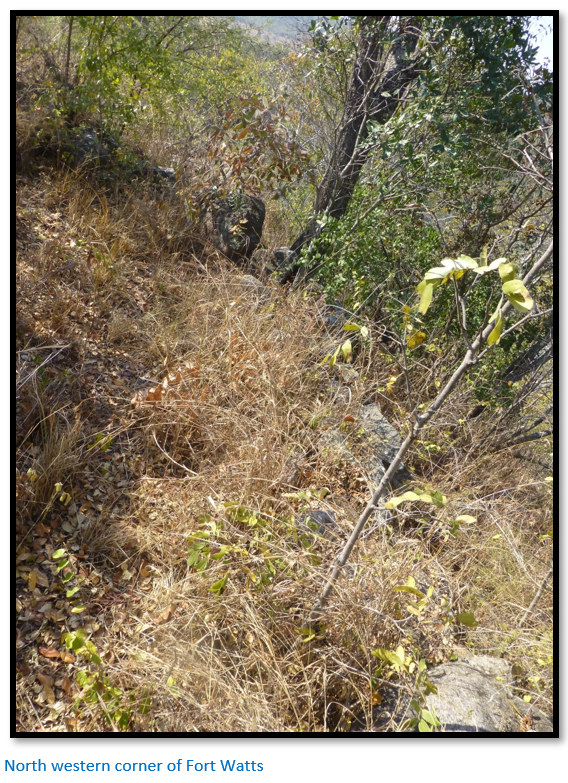
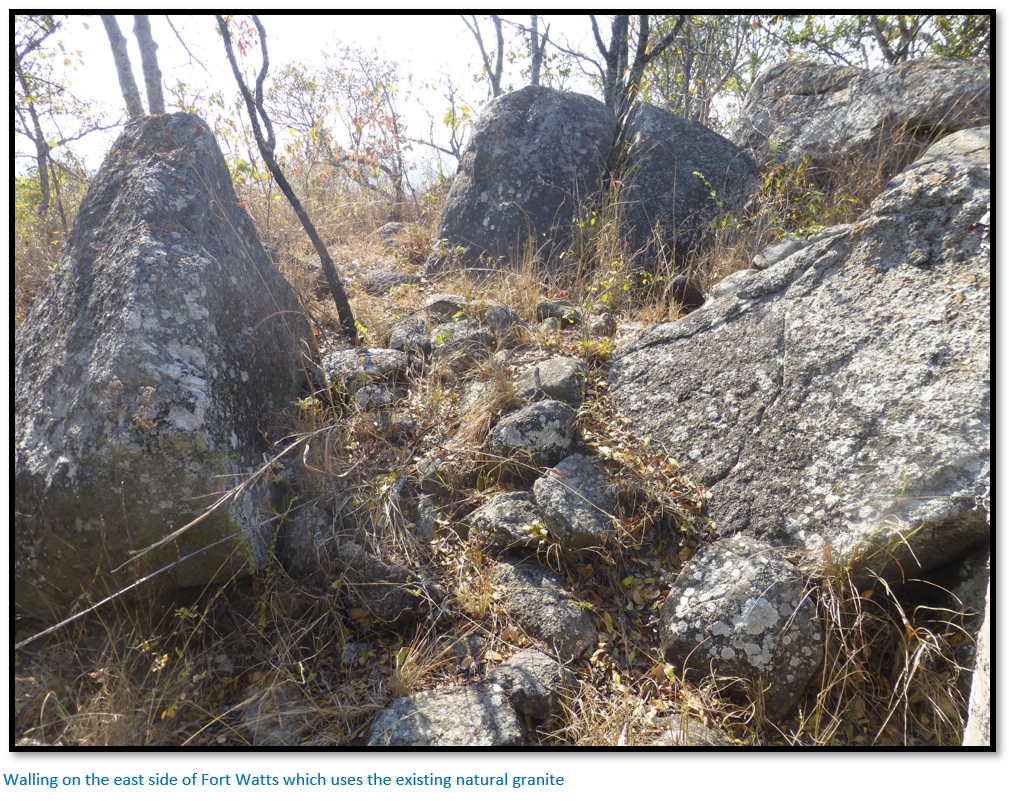
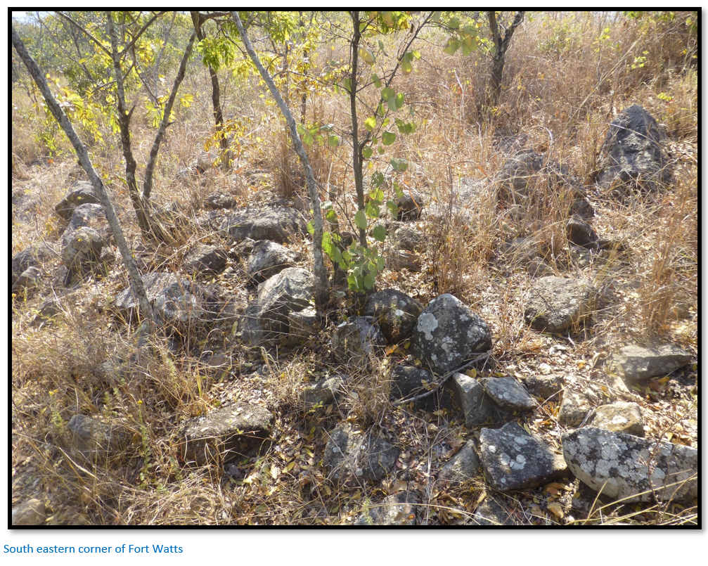
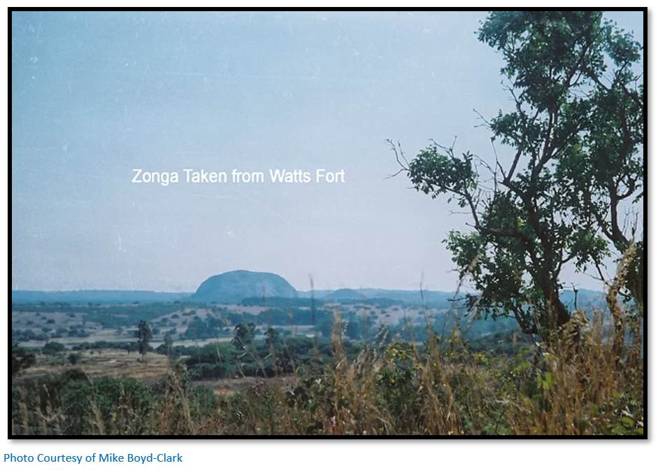
  • Fort Watts was built and manned in 1896 by Lt-Colonel Alderson’s Mashonaland Mounted Force and afterwards by the British South Africa Company Police but as far as I know there are no descriptions of the fort and its location has not previously been recorded. Fortunately, Mike Boyd-Clark had good recall and photographs from visiting the site when his family owned Castle Zonga Estate and Julian Misiewicz had childhood memories and photographs from when his family owned Devil’s Pass Farm whose northern boundary was at the base of the Devil’s Pass as can be seen from the 1:50,000 map section which follows. I am very grateful to both for being so generous with their knowledge and photographs.
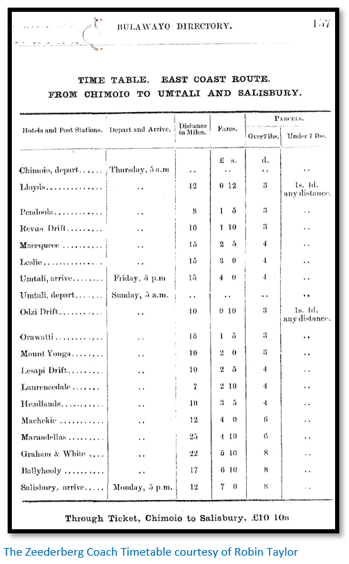
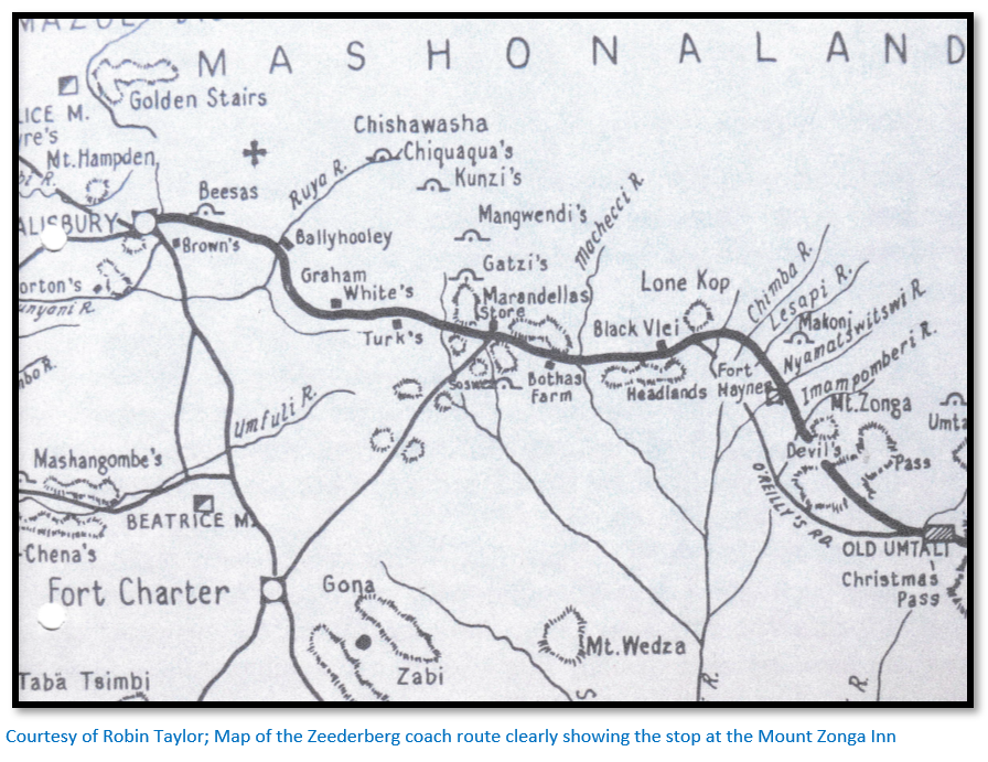
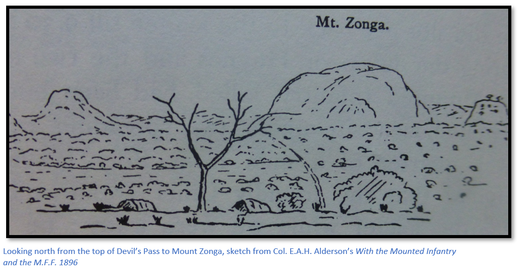
  • The Mount Zonga Inn and stables at the head of the Devil’s Pass no longer exist, but I am very grateful to the above two gentlemen for pin-pointing its position so accurately as many travellers in the early days would have dismounted from the Zeederberg Coach at this historic spot and stretched their legs whilst the coach mules were being changed before proceeding on to Salisbury. It was a 36 hour journey from Umtali to Salisbury.
 
How to get here: 

From Rusape take the A14 turnoff to Nyanga. Distances are from the turnoff; 7.5 KM pass on the left the turnoff to St Faith’s Mission, 17.9 KM turn right off the tarred road at the store. 18.2 KM turn right at the intersection heading for Mt Zonga in the distance. 20.5 KM take the left road at the intersection, heading due south, 22.9 KM take the right road at the intersection, now heading south west with Mount Zonga directly ahead. 27.5 KM turn left at the intersection away from Mount Zonga and heading for the Devil’s Pass ahead. 30.1 KM at the intersection turn left into the Devil’s Pass. See directions below for Fort Watts. 32.7 KM emerge from the Devil’s Pass, 33.9 KM continue directly on, 43.1 KM turn left at the intersection, 43.7 KM continue on the main road ignoring turnoffs and heading generally south. 56.1 KM reach intersection and continue on. 60 KM reach intersection and continue south. 66.2 KM reach intersection at Odzi Rapids Farm and continue south. 66.9 KM cross the Chingwandow River; 70.3 KM reach the A3 National Road and turn left for Mutare.

GPS ref for Devil’s Pass road north onto A14 near the business centre: 18⁰32′15.99″S 32⁰16′46.44″E

GPS ref for Devil’s Pass: 18⁰37′52.62″S 32⁰16′39.74″E

GPS ref (approximate) for Coach Stop, Inn and stables: 18⁰37′35.28″S 32⁰16′19.50″E

GPS ref for JB’s grave (approximate): 18⁰37′59.54″S 32⁰16′23.79″E

GPS ref for Fort Watts: 18⁰38′00.24″S 32⁰16′29.69″E

GPS ref for Devil’s Pass road south onto A3 near the Odzi River bridge: 18⁰54′51.08″S 32⁰24′05.22″E


Fort Watts and Castle Zonga Estate
The position of Fort Watts was given by Mike Boyd-Clark whose Grandfather Charles bought the farm in 1905 and farmed on Castle Zonga Estate until his death on 14th July 1932 and is buried at the St Faith’s Mission cemetery with the epitaph “vitai lampada tradunt” (they hand on the torch of life)
 
 
To get to Fort Watts go down the Devil’s Pass road at its western (uphill) end for approximately 350 metres and turn right onto a farm track just above an area which has been used for quarrying gravel for road building. Ignore tracks which turn to the left and keep to the uppermost track which leads to open cultivated fields and then turn left for 200 metres parking under a large Msasa tree. A walk of 200 metres north east across the cultivated lands leads to the cemetery and Fort Watts is 20 metres east of the cemetery. This area was resettled in 2002 and the graves in the cemetery are all recent.  
 
Fort Watts is perched on the very summit of the ridge and commands a good view all the way down the Devil’s Pass. The fort is rectangular in shape with longer walls of 20 metres to the north and south and shorter walls of 16 metres to the east and west. They are low-built granite walls and no attempt has been made to shape the stones. They may originally have been topped by sandbags; but no evidence of this remains and I saw no sign of an entrance. There are natural granite extrusions in the north west corner and the eastern edge and it does not look like any attempt was made to level the interior of the Fort. A prominent flat rock on the north east edge provides a good lookout point with views over the entire length of the Devil’s Pass road. A level area to the south east of the fort would have provided a good space for pitching tents. A faint track approaches from the north east and leads directly to the cemetery; this may be the original track to Fort Watts.    
 
The remains of a bully beef tin were found by the author in the field close to Fort Watt and this may be a remnant of the occupation of Fort Watts by the Mounted Infantry or the later BSA Police garrison.  As a young boy, Mike Boyd-Clarke, whose family owned Castle Zonga Estate found ginger beer bottles, Roses marmalade jars, spent and live cartridges, broken buckets, a rusty spur and a cavalry, or mounted infantry horse bit, shown below. 
 
The account by H.C. Thompson below shows that lions were still in the vicinity in 1897 as a mule was killed at the Inn the night before he arrived. Also Lt-Colonel Alderson’s Mashonaland Mounted Force may have left in October 1897, but there was still a detachment of British South Africa Police who he describes as: “discontented and wretched, badly housed and utterly uncared for.”


Lt–Col. E.A.H. Alderson in his book With the mounted Infantry and the M.F.F. 1896, states his force consisted of: 230 Mounted Infantry with two Maxims, 39 Royal Engineers, 14 Royal Artillery with two seven-pounders, 48 West Riding Regiment, 17 Honey’s Scouts, 92 volunteers of the Umtali Rifles and 50 wagon conductors, drivers and voorloopers to control the 38 mule and ox waggons.  Major E. Hamilton “Maori” Browne and Native Commissioner Ross advised against taking such a large group through the Devil’s Pass and they used the O’Reilly’s road which branched off the main road after the Odzi River and re-joined near the Nyamatswitswi River 13 KM south west of Chief Makoni’s stronghold. Here on the 2nd August they established Fort Haynes and converted the existing police huts into a hospital. 
 
 
Both the Devil’s Pass road marked as ‘main road’ and the O’Reilly’s road to the west are shown in the above map with Mt Zonga in the upper centre.


The day following the night attack on Chief Chingaira Makoni’s stronghold [see the article Fort Haynes and the fight at Chief Chingaira Makoni’s Kraal on the website www.zimfieldguide.com] Lieut-Col. Alderson took a company of the Mounted Infantry, Honey’s Scouts and a few engineers with an empty mule waggon back towards Umtali to reconnoitre the Devil’s Pass and to mend the telegraph wire.
 
We found that the Pass had been evacuated by the enemy, apparently on the day in which we turned it from the south [see the route taken by the force on the O’Reilly’s road in the sketch map above ] Judging by the number of schances (small stone walls) and scherms (bush shelters) erected there, it had been held by some 500 men. 
 
 Below the pass we found the wire cut in two places; the poles, which were all rotten, had been knocked down, and the wire then hacked in two by battle-axes.
 
 
The Engineers then joined the wire and put up the poles; we then tapped it and got communication with Umtali whose inhabitants were delighted to hear of Makoni’s defeat.   


I telegraphed down to Umtali reports of the action, to be sent on, on the first opportunity, to the High Commissioner and to the Chief Staff Officer at Buluwayo. While I received a message from the latter (which had been waiting at Umtali) that it was important to get supplies up to Salisbury as soon as possible. 
 
On the way back we burnt several kraals, including the one shown below. This is very typical of the bulk of the Mashona kraals. 
 
 
We did not get back to the laager until 9:30. [4th August 1896]
 
During the day poor Haynes and the two men of the Mounted Infantry, killed, had been buried in a well-chosen site under two spreading trees, about a quarter of a mile from Fort Haynes. We found that the friendly Chief Dafunya had visited the laager while we were away; he informed Godley that Chief Chingaira Makoni had thought that our avoidance of the Devil’s Pass meant that we were afraid to attack him.”  
 
Lt-Col. Alderson was commander of the Mashonaland Mounted Infantry and the local volunteer forces during a five-month campaign that lasted from July 1896 until Col. Alderson handed over his command to Col. De Moleyns of the British South Africa Police on 12th December 1896. The British South Africa Police and the 7th Hussars then carried out joint operations until the 7th Hussars left in early October 1897 by way of Beira. 
 
A chain of fortified posts was established at Devil’s Pass, Headlands and the Ruzawi Inn (south of  Marondera) They were garrisoned by local volunteers and the Mashonaland Field Force under Major C.W. Watts. The main purpose of Fort Watts would have been as a secure base from which to operate horse patrols and to ensure the road remained open and that the telegraph wire between Umtali and Salisbury was not cut again.
 

No. of men

Unit

Post

Kilometres from Salisbury


Salisbury

0

70

Matabeleland Relief Force

Marandellas No V Fort

83

30

Umtali Rifles

Headlands No IV Fort

142

50

Det. 2 / West Riding Regt.

Fort Haynes No III Fort

176

50

Det. 2 / West Riding Regt.

Devil's Pass (Fort Watts) No II Fort

197

50

Det. 2 / West Riding Regt.

     Umtali No I Fort


70

Umtali Rifles

Umtali No I Fort

248

30

Matabeleland Relief Force

Umtali No I Fort 


350


Today there is nothing apart from the rough granite stones outlining Fort Watts to remind us that 50 mounted troopers were stationed here from August to December 1896. 


Devil’s Pass in 1897
H.C. Thomson who wrote the book Rhodesia and its Government travelled through the Devil’s Pass in 1897 and wrote: When I left my companion, it was still early in the afternoon, and, as I had the two boys with me, I felt sure I could not miss my way. But the view from the kraal was a glorious one, and I remained looking at it so long that it was dark hours before we reached the Fischer’s' farm. The boys had not been there before, and only vaguely knew its whereabouts. They lost their way completely, and we wandered on and on in the darkness until I began to think we should have to “camp out,” not a particularly cheerful prospect with lions about. About nine o'clock we came to a kraal high up on the side of a hill; the dogs barked and the women shrieked, and we could see torches being carried hither and thither. The rebellion had only just been put down, and I was afraid to go up and ask the way, so I motioned to the boys to keep straight on. Luckily, the kraal had put them right in their bearings, and they knew from it where they were, and in another half-hour piloted me safe through to my destination.
 
It was not a pleasant walk, for I had no firearms of any kind with me, not even a revolver, only my camera  and I felt nervous about snakes, and still more about lions; but when it was over I felt glad to have gone through it, and to have experienced the intense, silent loneliness of the open veldt. The natives were burning the long grass before the rains, and the crackling columns of flame, leaping along the mountain side in the moonless night, had a sublimity that I shall never forget.
 
On the following day I bade good-bye to my kind friends, the Fischer’s, and started with my boys for Le Sapi. There I took advantage of a Cape cart, on its way down to Umtali, to return to the Devil's Pass, which I was anxious not to miss. On the way we passed by Mount Zonga, an odd sugar-loaf hill, which the Mashona assert was transported bodily from Gazaland, and deposited where it now stands. The Devil's Pass I thought disappointing, and the view from it not nearly so grand as that from the Christmas Pass, but it has a bad reputation for lions, as had Christmas Pass had in the pioneer days of Umtali. The night before my arrival they had killed a mule thirty yards behind the store. The mules for the coach are kept at the top of the pass, and the storekeeper, hearing a great noise in the stables, got up to see what it was, and was standing at the door of his tent when they broke loose, and stampeded wildly past. The lions must have been amongst them at the time, for on the following morning he found the spoor of two, and the remains of a mule they had killed and eaten immediately behind the hut. In addition to the store, there is a police camp on the pass, in which the men were discontented and wretched, badly housed and utterly uncared for. 
 
The same state of things existed in the police-camp at Old Umtali, where things might surely be better managed. The food served out was insufficient, and there were no arrangements for having it properly cooked; and the men had no proper kit. They were sleeping on the ground instead of on stretchers, which might easily be made at a very small cost; or the men might be employed to make rough stretchers for themselves; they would be a great preventive of fever. In Umtali they have the advantage of a doctor and a hospital, but in the isolated police camps there is neither, and I heard many sad stories of untended illness and death. What is particularly hard is that recruits from England have to undergo a medical examination at Salisbury before they are finally taken into the force, and if they fall sick on the way up from Beira, before they reach Salisbury, they have to pay for their medical and hospital expenses out of their own pockets, and if they are finally rejected, they have to find their way back without pay through a country in which travelling is phenomenally expensive. 
 
The hardships experienced in the pioneer days were intelligible; there were no means of communication; but the men understood before they enlisted that they would have to rough it and bore their privations cheerfully. Now they are led to believe that they are going out to a settled country, with a proper administration; and if a little trouble were taken there would be no necessity for the way in which they are treated. Other people in Mashonaland do not have to suffer as the police are made to suffer. It is entirely a matter of faulty administration, for in Matabililand (Sic) the police are in a very different state. The result of their treatment in Mashonaland is that almost the whole of the force is in a state of dangerous discontent, and I think if men in England knew the kind of life they would have to lead that very few would enlist. 
 
…From the Devil’s Pass I returned to Le Sapi, and from there walked onto headlands, with a couple of boys kindly obtained for me by Mr Ross, the native commissioner. I sent them on by the main road and walked myself across the veldt with a Mashona guide through the exquisite mountain scenery of which Professor Bryce has given so vivid a description. At Headlands, which is 5,200 feet in height, I found Mr Pretorius combining farming and store-keeping. They have built for themselves one of the few brick houses between Umtali and Salisbury and have a comfortable homestead with a fair amount of stock, upon which they have chiefly relied for a livelihood."
 
 
The Zeederberg Coach Stop, Mount Zonga Inn and Stables
Mike Boyd-Clark writes that his step-grandfather – Sixer Everard kept Blackhead Persian sheep in the former mule pens of the Mount Zonga Inn which were off the track leading from the top of the Devil’s Pass. The Inn is believed to have originally belonged to Rhys Seymour Fairbridge and being an enterprising man, Fairbridge thought the spot would be developed into an important stop on the way between Umtali and Salisbury. This idea would have quietly died when construction of the Umtali-Salisbury railway was completed in 1899 and the new Umtali-Salisbury route was established 12 miles to west where it runs through the present-day location of Inyazura, now Nyazura.
 
This table of distances between Zeederberg Coach stops between Umtali and Salisbury was kindly provided by Robin Taylor.


Miles

Total miles

Kms

Total Kms

Umtali


Odzi Drift  

10

10

16

16

Orawatti 

15

25

24

40

Mount Zonga

10

35

16

56

Lesapi Drift

10

45

16

72

Laurencedale

7

52

11

83

Headlands

10

62

16

99

Macheke

12

74

19

118

Marandellas

25

99

40

158

Graham and White Store

22

121

35

194

Ballyhooley Hotel

17

138

27

221

Salisbury

12

150

19

240


150


240


The above timetable shows that from the railhead at Chimoio the coach left on Thursday at 5am and reached Umtali on Friday at 5pm some 36 hours later. After a two nights rest the coach then left Umtali on Sunday at 5am and reached Salisbury on Monday at 5pm after another journey of 36 hours. Mount Zonga is misspelt on the timetable Yonga)  
 
Mike Boyd-Clark says his grandmother Maud Boyd-Clark (Everard) told the following story: “Early one morning at the Inn a couple of guests were rudely awakened and told to get up as their sheets were required as cloths for the breakfast table."


Castle Zonga Estate
The homestead [photo below] of Castle Zonga Estate was built by Charles Boyd-Clark at the head of the Devil’s Pass and the property extends all the way down down the Devil’s Pass itself. Rhys Fairbridge was the original owner of both the Zonga and Devil's Pass properties, receiving the properties from the BSA Company in lieu of fees for his surveying work of the farms throughout the district, including surveying the original town plans for Umtali and Rusape. Rhys Fairbridge sold Castle Zonga Estate in 1905, after the railway was built, to Charles Boyd-Clark.


Devil’s Pass Farm
The boundary of the Devil’s Pass Farm begins at the bottom of the Devil’s Pass and continues down the length of the road towards Chipanga stream, a tributary of the Inyamazura river. Rhys Fairbridge is believed to have held on to the Devils Pass Farm for some time before selling at about the time of the First World War to two brothers: Frank Everard and George Haywood Everard. They had served with the British army in India; George died circa 1967 and is buried in the Inyazura cemetery located at the junction of the Pass Road and the A3 Umtali-Rusape national road. The original homestead on the farm is believed to have been built by Rhys Fairbridge.  


Acknowledgements
Mike Boyd-Clark for supplying information on Fort Watts, the Inn and stables and Mount Zonga Estate and the many photographs acknowledged in the article
Julian Misiewicz for his memories of living on the Devil’s Pass Farm and photographs
R. Taylor for the Zeederberg coach timetable and map
Lieut-Col. E.A.H. Alderson. With the Mounted infantry and the M.F.F. 1896. Books of Rhodesia, Bulawayo 1971
H. C. Thomson, Rhodesia and Its Government. Smith, Elder & Co. 1898 


When to visit: 
All year around
Fee: 
None
Category: 
Province: